Friday, February 20, 2009

Pack Rat Falls

Pack Rat Falls is a neat waterfall located in a little canyon that is somewhat hidden away, you really have to know its there in order to find it. There isn't really a trail to the falls, and the way there has been rated as an "easy-medium bushwhack." To get there you start out from the campground by Haw Creek Falls, following a creekbed for a quarter mile to the falls. The creekbed is a bit deceiving as you start out, since it looks dry. But the creek that makes Pack Rat Falls runs underground before it runs into Haw Creek. As you walk along the creek, more and more water appears, and the creek runs and tumbles over several mossy rocks. At one spot, the creek cascades under a huge boulder and empties into a emerald pool.
P2172925

To reach the falls you have to cross over the wet and mossy rocks several times. The rocks in the creek are super-slippery, as if they had been coated in grease. I would step on rocks only to have my foot shoot out suddenly and fly off in some wacky direction that I never intended for it to do. But the little creek there holds a lot of personality, and it is quite scenic. There are several small waterfalls and cascades along the way to the falls.
P2172998

P2173008

After passing by several other small waterfalls and some neat bluffs, you get to finally see the big waterfall up ahead.
P2173034

And finally, the 24 foot tall Pack Rat Falls:
P2173079

I wondered how long that tree had been there...probably a long time.
P2173071

It is a very neat spot, and a place that not very many people ever reach.
P2173094

P2173096

On the hike back, I mostly kept the camera safely tucked away in the camerabag. I didn't want to slip and fall and break it while trying to make my way across a slippery rock. But there were several places that made me stop and get pictures of the creek. This one little waterfall was about halfway from the falls back to the campground.
P2173117

From there I made it back to the car and went on home. I'm eagerly awaiting another nice and cloudy day for another trip out to chase some waterfalls....

Thursday, February 19, 2009

Haw Creek Falls

Tuesday was a perfect day for taking pictures of waterfalls - cloudy and a little bit rainy. I had a plan to drive up into the Ozarks to hit a few waterfalls up around the Buffalo River. The only problem is that the Ozark National Forest is still cleaning up from the big ice storm a few weeks ago, and a lot of places up there are still closed. Before making the long drive up to the hills, I stopped at the forest ranger's office in Clarksville to see if the trail was open. Nope, they said, the trail was closed and the waterfall was inaccessible. The only spot in the National Forest that is open was Haw Creek Falls, which didn't see much damage from the storm. I briefly thought about driving up to the trail anyways, but instead just made the short drive over to Haw Creek Falls. It is a neat place, but one that I've been to a gazillion times already.

Driving along the curvy road towards Haw Creek Falls, I spotted several small waterfalls that flowed down the hills along the road. This was good news, it meant that there would at least be a lot of water in the waterfall. Now Haw Creek Falls isn't the tallest waterfall around, but it is a scenic little spot.
P2172832

Plus it is amazingly easy to reach, you can pretty much see it from the road through the campground there. My problem with the falls is that I've been there so many times in the past and it's hard to find a new angle to get of them.
P2172866

And one more shot from Haw Creek Falls:
P2172890

From there I had two options: hike to the waterfall at Pam's Grotto, or hike to Pack Rat Falls. Since I've been to Pam's Grotto a few times already, I decided to go to Pack Rat Falls, which was just about a quarter mile away...

Monday, February 16, 2009

Kings River Falls

On Friday the 13th (scary!), I made the long drive over to Kings River Falls, located out in the middle of nowhere (or in Madison County, up in the Ozarks). To get there you drive up Hwy. 23 from Ozark, then go east on Hwy. 16 for a bit. You get to pass through the town of Boston (which comprises of about 5 buildings), before turning off onto a few miles of dirt roads. This was one of the old buildings along the way to the falls.
P2132497 copy

To reach the falls, I was using a very well-written guidebook that provides mileage details and specific instructions. The book has been an important tool for finding waterfalls, unless of course you don't read it right and go off in the wrong direction.

Which I did. Instead of turning left towards the waterfall I turned to the right. Bizarrely, the directions would match up perfectly with the area I was driving into, even if it was going the wrong way. For example, the directions said to cross over a bridge, then turn right onto a small road that looks like a driveway. I ended up crossing over a bridge and then saw a small driveway-like road. The directions then said to follow this short road until it ends at a small parking area next to an old barn and farmhouse. The road I was on actually did end up at a small parking area, next to some sort of old barn or shed. Thinking I was at the right place, I got the camera stuff out and looked to find the trail. How weird, I thought, that there wasn't a sign or anything. I walked around a bit trying to find the trailhead, wandering back and forth along a large creek. There was some sort of trail that started out across the creek, so I crossed it just in case it was where I was supposed to go. Nope, it was some sort of 4-wheeler trail that ended up running right into another creek. "Now this isn't right," I thought to myself, "where the heck am I?" I went back to the car and passed by some sort of computer equipment or electrical hardware lying on the ground. I looked closer and saw that it was covered with bullet holes. "This isn't good..." I thought again to myself. I hurried back to my car, looking closer at the old shed along the way. There were a few empty beer cans scattered along the ground, along with a few spent shotgun shells.

Apparently I had unwittingly stumbled onto some sort of scary redneck/hillbilly hangout (not to be stereotypical, but there was an actual outhouse near the old shed - I didn't take a closer look at that). Luckily there wasn't anyone else there, and I drove away as fast as I could. Back on the road I saw where I got lost, and amazingly the trailhead to the waterfall was just about two minutes away. I found the parking area - with nice signs pointing out that it was the trailhead for the Kings River Falls Natural Area - and started on the hike.

The trail to the falls is about 1.5 miles long, and it runs alongside a field that is overlooked by the old barn and a quaint old farmhouse. The trail soon curves around to meet Kings River, running alongside the river. Along part of the trail is an old rock wall. The guidebook said the rocks were cleared from the field and stacked here over 100 years ago.
P2132502 copy

P2132506

I was happy to see a lot of water at Kings River. There were several spots with some cool little rapids and waterfalls that I stopped at along the way.
P2132513

P2132517

P2132534

P2132538

And then finally, the trail reaches the big waterfall along the river:
P2132576

The waterfall is only about 10 feet tall, but it makes for an impressive sight. The natural beauty of it made me easily forget the trouble it took to get there. I scrambled around and took a ton of pictures of the falls, so forgive me for posting a bunch of them here:
P2132558

P2132596

P2132615

P2132639

P2132644

Another small stream flows into Kings River just above the falls. There were several small waterfalls and cascades on the creek as it made its way down to the river. Having felt that I had taken enough pictures of Kings River Falls, I went up and explored that area a bit more.
P2132651

P2132660

Following the creek a bit further up, there were even more little waterfalls. It was a nice and scenic little area.
P2132666

The way up there pretty much stopped at this little waterfall. If I tried I probably could have found a way up farther, but instead I ended the trip with this little waterfall that fell in an emerald and mossy pool.
P2132681

Sunday, February 15, 2009

Overlooking Cedar Falls

Petit Jean Mountain has some great waterfalls. I didn't have time to make the hike down to Cedar Falls (which I hiked to last month) Luckily, there are a few overlooks you can take that provide some nice views of the falls. One of those overlooks is just a short drive from the Seven Hollows Trail. This was taken along the boardwalk leading down to the edge of the bluff.
P2102436

And the view of Cedar Falls, from above. Only from this angle can you appreciate how high the cliffs are around the falls. They stand far above the falls, which are 95 feet tall.
P2102448

And one more shot of the falls:
P2102453

There has been a lot of rain around here lately, so the waterfalls are thriving. Luckily enough I am unemployed at the moment, so I've had some free time to go driving out to some waterfalls. Coming soon - some shots from Kings River Falls in the Ozark Mountains...

Saturday, February 14, 2009

Seven Hollows Trail

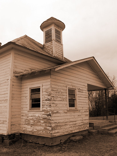
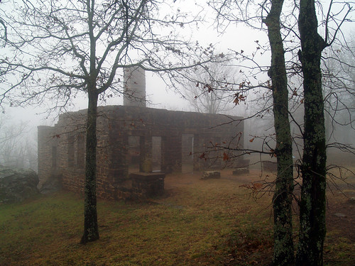
Before starting the Seven Hollows trail, I made a quick stop at the old pioneer cabin at Petit Jean. The cabin sits at the trailhead for the Cedar Creek trail, which I intend to hike again sometime soon (no time that day). The cabin was built sometime around 1845.
P2102228 copy

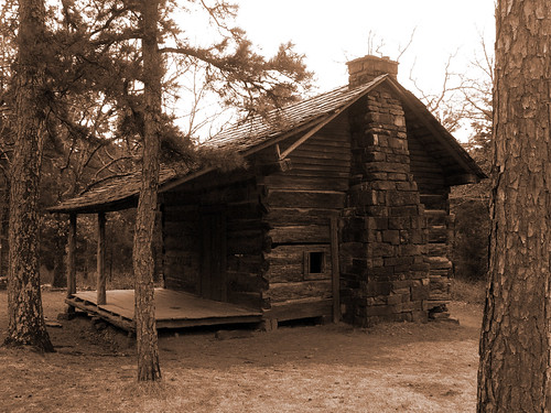
I had to try to find a way to avoid getting a few signs in the shot. Ones gives the history of the building. The other sign warns against people being a-holes and leaving graffiti there (I paraphrase that part), since the building is old and historic and whatnot.

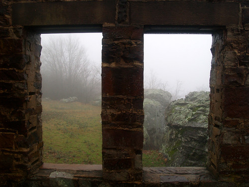
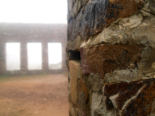
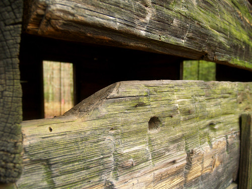
This was taken looking through some of the old boards of the cabin:
P2102230

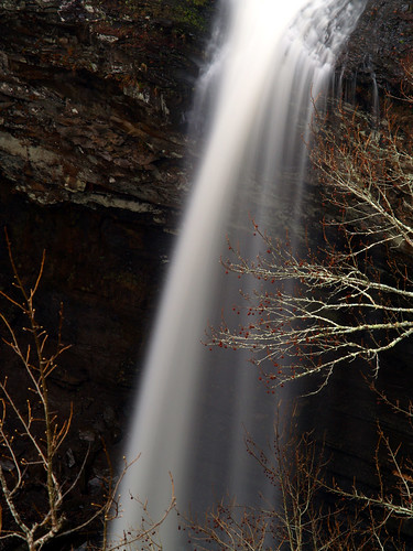
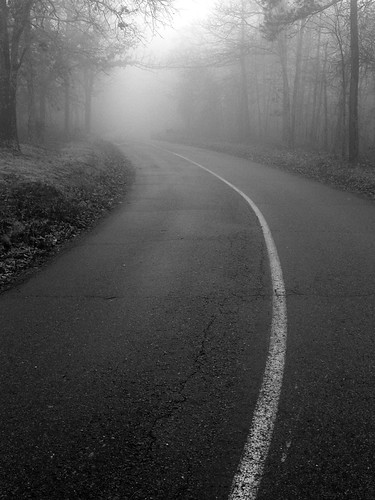
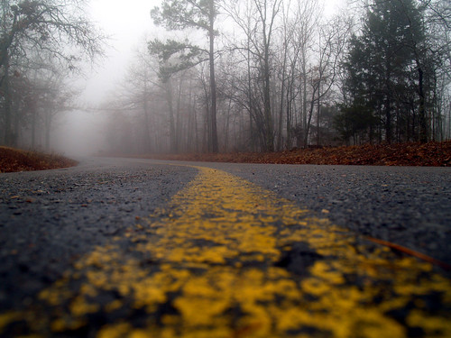
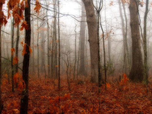
And then it was on to the Seven Hollows Trail. Oddly enough, the Seven Hollows Trail actually only visits four hollows. But there are a few interesting sights in the hollows that it visits - including a few waterfalls, a natural bridge and several caves. Most of this area burned in a wildfire in 2000, and while the forest is slowly recovering it still does look a bit well-done in places.

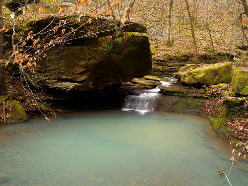
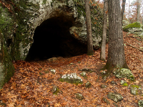
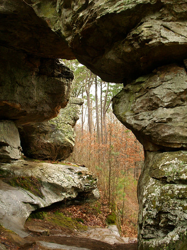
The trail starts out and drops down into the first hollow, running alongside a small creek. There are several caves along the bluffs there, this is the view looking out from one of them.
P2102233

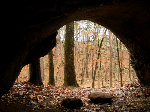
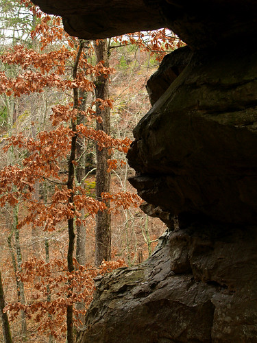
And the same cave from the outside:
P2102242

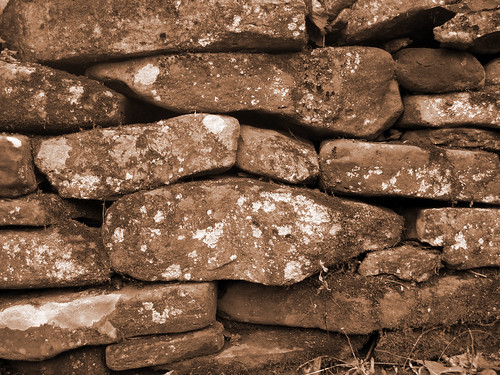
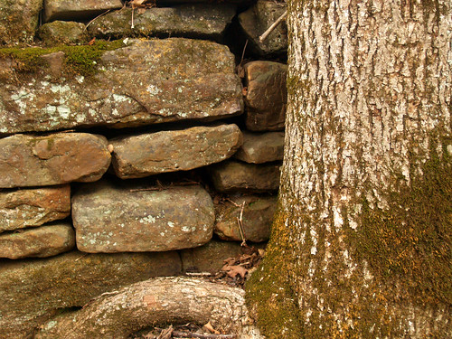
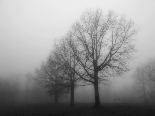
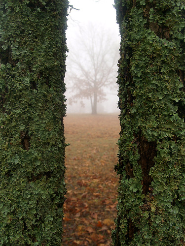
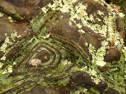
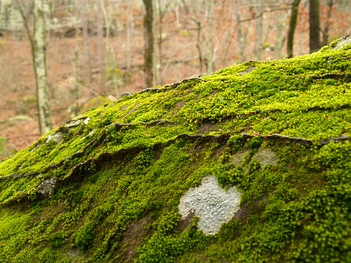
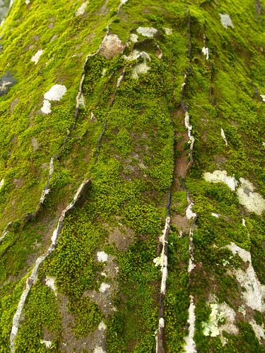
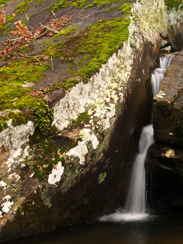
Petit Jean Mountain is known for its romantic history (hey, Valentine's Day!), and for it's scenic beauty. I think one of the coolest things about the park are the rocks there. The rocks along the trail had some interesting designs, which were married with a different mixture of moss or lichen.
P2102249

P2102257

P2102258

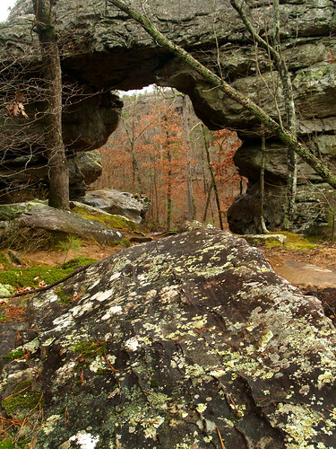
About 1.5 miles into the hike, you reach the "natural bridge." Now I don't really think this counts as a natural bridge, it's more of an arch. It's not like you could drive or walk across it, but oh well. The bridge or arch is about 30 feet tall..
P2102262

P2102277d

P2102282

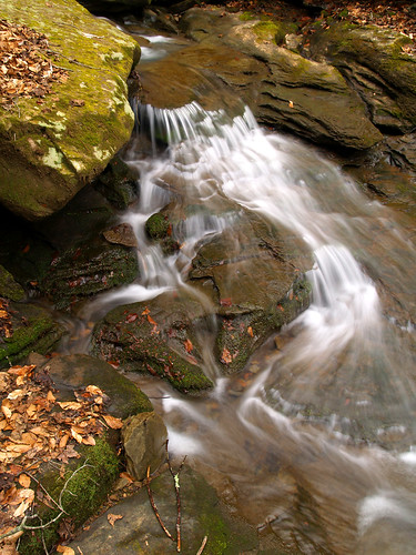
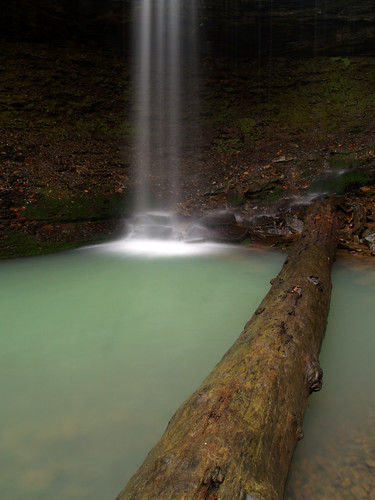
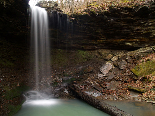
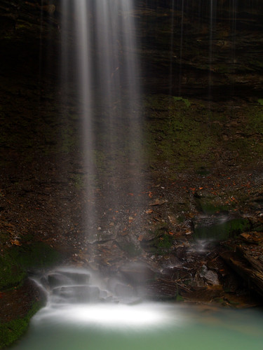
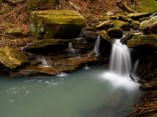
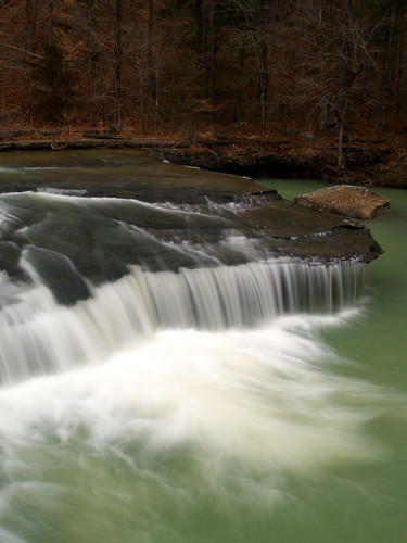
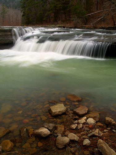
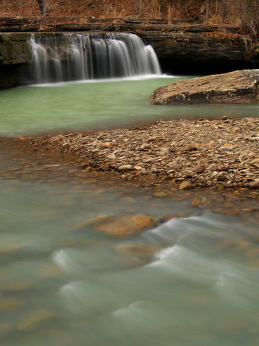
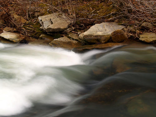
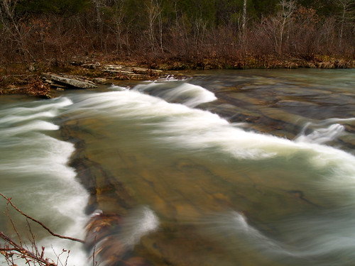
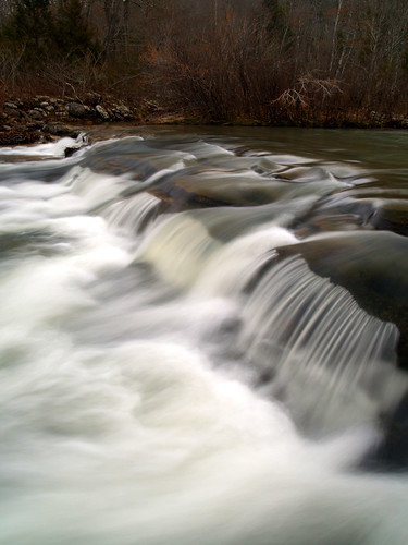
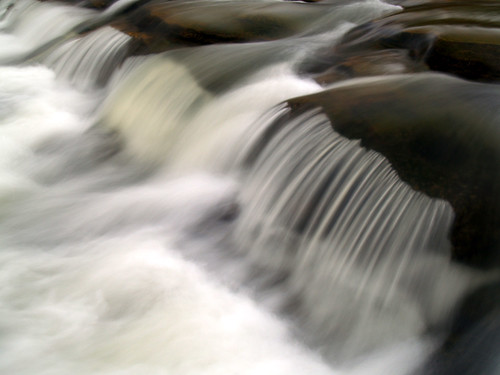
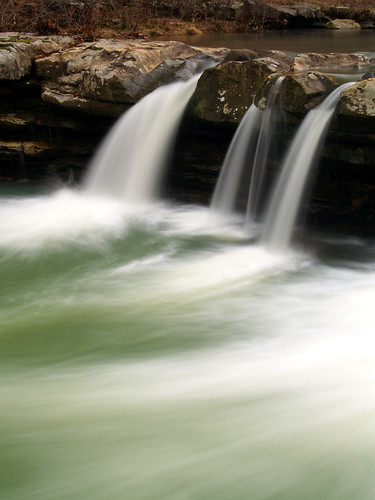
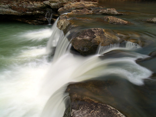
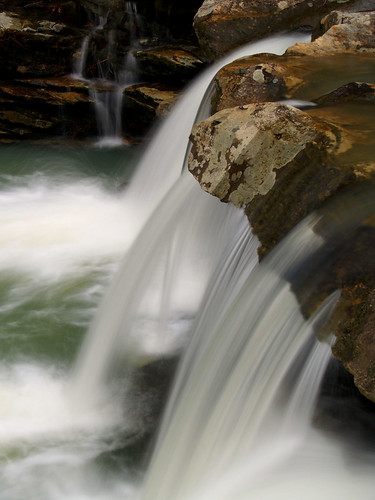
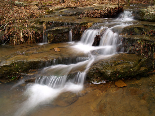
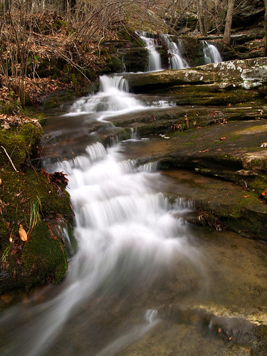
From the "natural bridge" the trail continues on, running alongside the creek. That creek does create a few waterfalls, and I stumbled and walked across a fallen tree to get in position to get these shots of some small waterfalls.
P2102294

P2102299

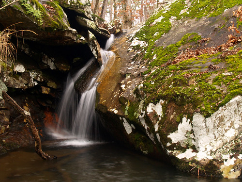
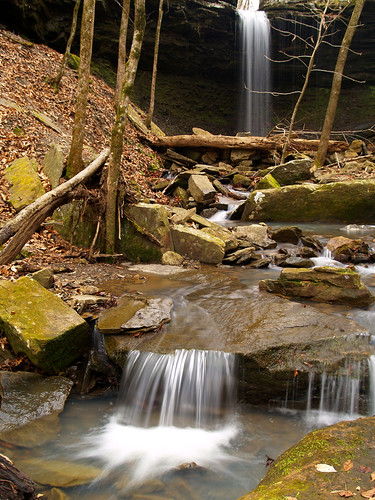
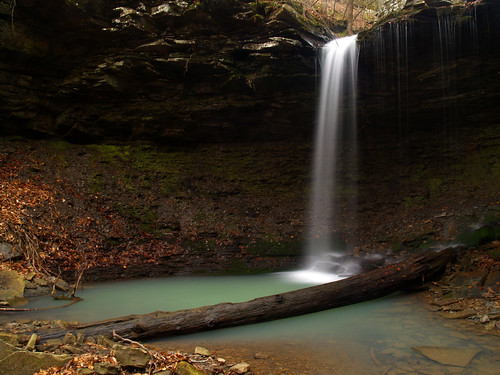
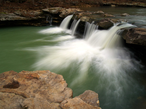
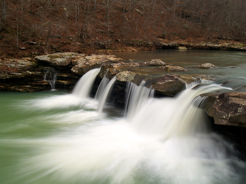
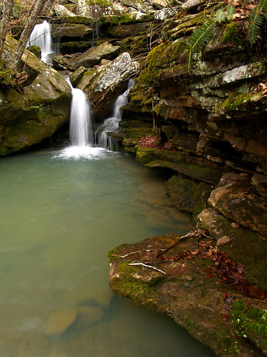
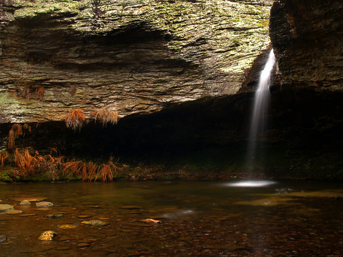
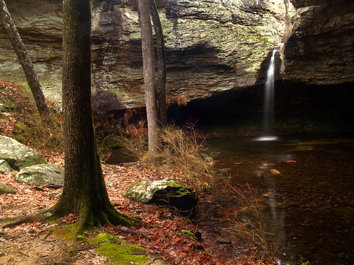
There is another waterfall along the trail, located in a grotto along one of the hollows. It isn't the tallest of waterfalls around, only 18 feet. But I have made this hike a few times and have found this waterfall not running. With all the ice and rain we've had lately, I thought I might actually get to see it running. So after two miles or so of hiking, I finally made it to the hollow to find the waterfall there...
P2102322d

P2102338d

While taking pictures there I heard something odd in the distance. It took me awhile to realize that it was thunder. While it was cloudy and overcast, it hadn't rained on me while I was out on the trail. Now it sounded like a storm was making its way towards Petit Jean. It was bizarre weather - we just had an ice storm a few weeks ago, now we're getting thunder storms. What's next, a hurricane?

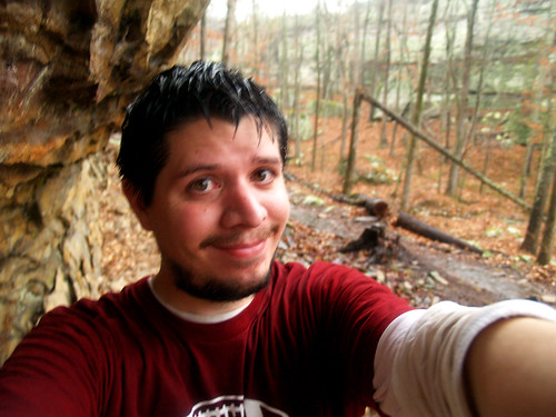
The Seven Hollows Trail is 4.5 miles long and rated as a "medium" level hike. I was about halfway through it while a storm was approaching. I hurried along the trail, walking as fast as I could and trying to get the hike done before the worst of the storm hit. Looking back, it probably would have been wiser to have stayed at the grotto, since it had a nice little cave-like area to take shelter in. Instead I hiked in a rain that started to get heavier. I did have an umbrella with me, but since it had metal in it I thought it would be best not to open it in a thunderstorm (especially since I was carrying a metal tripod at the same time). Luckily the camerabag is waterproof.

After walking about a mile, the rain started to fall heavier. The lightning and thunder sounded like it was getting closer. I decided to take shelter under a bluff, which seemed a bit better than hiking alongside tall trees. As I sat and rested, I saw some lightning flash across the sky. I had some time to kill, so I took this dorky and soaked self-portrait as I waited out the storm.
P2102379

About 30 minutes later, the worst of the storm seemed to have moved on and it wasn't raining that much. I started back on the trail, looking forward to getting to my car at the end of the trail.

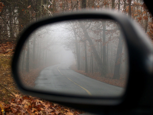
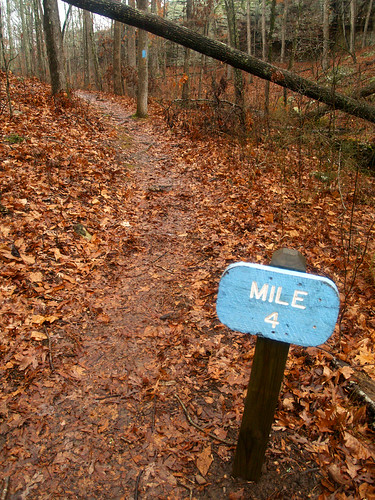
Mile 4...Almost finished!
P2102395

A bit later I finally made it back to my car, where I was pleased to find some spare and dry clothes to change into. Although I was soaked, I've been on worse hikes. This trip through Seven Hollows doesn't even compare to a trip taken about this time last year while trying to reach Twin Falls at Richland Creek (for that adventure, click HERE).

Thursday, February 12, 2009

Petit Jean in the fog

On Tuesday I left in a light rain for another visit to Petit Jean Mountain. I was pleased to see that the top of the mountain was shrouded in a thick fog, so I quickly headed over to the overlook by Petit Jean's gravesite. While there wasn't any view there thanks to the fog, it was really pretty up there.
P2102170 copy2

This is the old CCC lodge at the point, nearly obscured by the fog:
P2102184

P2102188

P2102198

As my cousin Jon would tell you, I'm a huge sucker for pictures of roads leading off into the distance. So naturally the road and the fog drew me in and I spent a good amount of time just taking pictures of that...
No Line On The Horizon

Luckily, there wasn't much traffic that day...
P2102207

These two oak trees were growing up right next to each other, creating a sort of tree sandwich...
P2102216

I had a plan to hike the 4.5 mile Seven Hollows trail, so I decided I better head on and get that hike started. But it was hard to resist stopping to get a few more pictures. This was taken from the passenger side window of the car.
P2102219 copy

And this from the driver's side window:
P2102220

I was sad when I drove out of the fog, I would have liked it to have been along the trail too. But that wouldn't be the end of the wacky weather up there. As I drove off to the Seven Hollows trailhead, there was a thunderstorm coming closer and closer to Petit Jean...